本文已被:浏览 907次 下载 496次
投稿时间:2025-06-16 修订日期:2026-01-06
投稿时间:2025-06-16 修订日期:2026-01-06
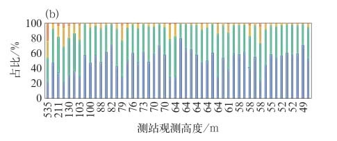
中文摘要: 基于激光测风雷达数据,采用风廓线幂律(WPE)方法,计算了不同地面风力条件下50~500 m高度范围内的风廓线指数,并通过50个观测高度超过40 m的气象站数据进行验证。结果表明,由激光测风雷达反演的风廓线指数存在系统性高估问题,且误差大小与观测区域的建筑物密度和高度特征密切相关。针对这一问题,引入百米级网格建筑物密度和平均高度参数,构建了多因子驱动的风廓线指数动态修正算法,改进了传统方法依赖单一粗糙度参数的局限性。修正后,91.7%的风力计算误差被控制在1级范围内,其中50.1%达到零误差。基于此,进一步开发了面向城市复杂建筑物环境的近地层高空风场三维重构模型,其具备100 m水平分辨率和50~500 m垂直覆盖范围,实现每5 min实时监测和最长168 h的预报输出,为城市高空作业安全提供了低成本、高精度的风灾防控技术路径,具有业务推广潜力和工程应用价值。
Abstract:Using wind-measuring lidar wind profiler data and the wind profile exponent (WPE) method, we calculate the WPE within the 50-500 m height range under different surface wind conditions in this study. Then the results are validated using data from 50 meteorological stations with observation heights exceeding 40 m. The results indicate that the WPE retrieved from wind-measuring lidar has the problem of systematic overestimation, with the error magnitude closely related to the building density and height characteristics of the observation area. To address this issue, building density and building average height parameters on a 100 m×100 m grid are introduced to develop a multi-factor-driven dynamic correction algorithm for the WPE, which overcomes the limitation of traditional methods that rely solely on a single roughness parameter. After correction, 91.7% of the wind force calculation errors are confined within the range of 1 level, with 50.1% showing zero error. On this basis, a three-dimensional high-level wind field reconstruction model tailored for urban complex building environments is further developed. This model has a horizontal resolution of 100 m and vertical coverage from 50 to 500 m, enabling real-time monitoring every 5 min and forecast outputs up to 168 h. The model can provide a low-cost, high-precision wind disaster prevention and control technology pathway for urban high-level operations, having business application potential and engineering value.
文章编号: 中图分类号: 文献标志码:
基金项目:广东省气象联合基金项目(2024A1515510011)和粤港澳大湾区气象科技协同攻关项目(GHMA2024Y05)共同资助
引用文本:
王婷,张锦城,胡琳,2026.多因子耦合的近地层风廓线指数修正算法[J].气象,52(8):999-1007.
WANG Ting,ZHANG Jincheng,HU Lin,2026.Multi-Factor Coupled Correction Algorithm for the Near-Surface Wind Profile Exponent[J].Meteor Mon,52(8):999-1007.
王婷,张锦城,胡琳,2026.多因子耦合的近地层风廓线指数修正算法[J].气象,52(8):999-1007.
WANG Ting,ZHANG Jincheng,HU Lin,2026.Multi-Factor Coupled Correction Algorithm for the Near-Surface Wind Profile Exponent[J].Meteor Mon,52(8):999-1007.