本文已被:浏览 868次 下载 567次
投稿时间:2024-12-25 修订日期:2026-06-26
投稿时间:2024-12-25 修订日期:2026-06-26
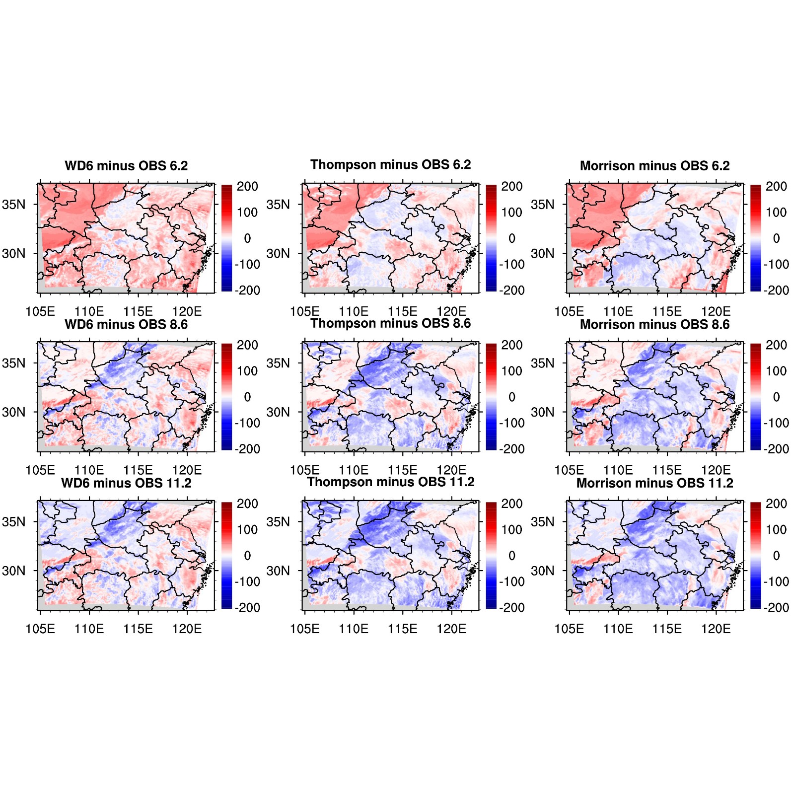
中文摘要: 针对2016年6月29日至7月1日一次由青藏高原东移云团造成的长江中游强降水过程,基于卫星观测资料和通用辐射传输模式(CRTM),对WRF模式模拟的三种云微物理方案进行评估。结果显示:与高分辨率卫星融合降水相比,三种方案均很好地模拟了降水的发生、发展与成熟阶段,其中Morrison模拟效果最好。然而三种方案在固态水凝物的模拟方面具有较大的不确定性,与葵花8亮温数据和ERA5云量相比,三种方案低估了中低云云量,高估了高云云量。通过与卫星反演云产品对比发现,三种方案因模拟的云水和云冰总含量偏小、云有效半径偏大造成在雨区模拟的下行短波辐射偏小。与GPS大气可降水量相比,WRF模式模拟所用初始场水汽在降水区域偏低。模拟极端降水的误差是热力、动力和云物理综合作用的结果,本文结果为极端降水模拟评估与改进提供了借鉴。
中文关键词: 亮温,通用辐射传输模式(CRTM),云微物理方案
Abstract:Based on satellite observations and the community radiative transfer model (CRTM), this paper evaluates the simulation results of three cloud microphysical schemes (Morrison, Thompson, and WD6) aiming at a heavy precipitation event in the middle reach of Yangtze River. The heavy precipitation once occurred from 29 June to 1 July 2016 and was brought by the clouds moving eastward from the Tibetan Plateau. The results show that compared to the high-resolution fused satellite precipitation observations, the three cloud microphysical schemes perform very well as a whole. They all successfully simulate the beginning, developing and the maturing stages of the precipitation event, of which the performance of Morrison scheme is the best. However, the three schemes have greater uncertainties in simulating the solid hydrometeor. Relative to the ERA5 cloud cover data and the brightness temperature observation from Himawari-8, the three schemes overestimate the high cloud cover but underestimate the mid-low cloud cover. Compared to the satellite-retrieved cloud products, it is found that the downward shortwave radiations simulated by the three schemes are smaller in the precipitation area due to the smaller contents of cloud ice and cloud water as well as the larger cloud effective radius. Furthermore, the initial field water vapor used in WRF model simulation is less than the GPS atmospheric precipitable water in the precipitation area. The error of extreme precipitation simulation is the result of the combined effects of thermodynamics, dynamics, and cloud physics. These findings could serve as a reference for the evaluation and improvement of extreme precipitation simulation.
keywords: brightness temperature, community radiative transfer model (CRTM), cloud microphysical scheme
文章编号: 中图分类号: 文献标志码:
基金项目:湖北省气象局科技发展基金青年项目(2019Q04)和全国暴雨研究开放基金(BYKJ2024M12)共同资助
引用文本:
骆三,余洋,李红莉,张文,王俊超,2026.基于卫星观测资料对中尺度模式云微物理参数化方案的评估分析[J].气象,52(8):928-941.
LUO San,YU Yang,LI Hongli,ZHANG Wen,WANG Junchao,2026.Evaluation of Cloud Microphysical Parameterization Schemes for Mesoscale Model Based on Satellite Observations[J].Meteor Mon,52(8):928-941.
骆三,余洋,李红莉,张文,王俊超,2026.基于卫星观测资料对中尺度模式云微物理参数化方案的评估分析[J].气象,52(8):928-941.
LUO San,YU Yang,LI Hongli,ZHANG Wen,WANG Junchao,2026.Evaluation of Cloud Microphysical Parameterization Schemes for Mesoscale Model Based on Satellite Observations[J].Meteor Mon,52(8):928-941.