本文已被:浏览 523次 下载 4481次
投稿时间:2020-09-17 修订日期:2021-08-11
投稿时间:2020-09-17 修订日期:2021-08-11
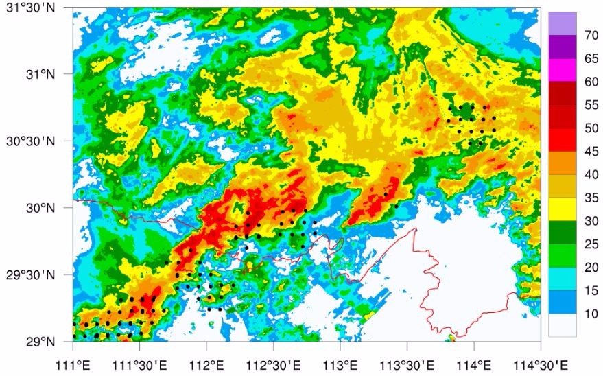
中文摘要: FY-4闪电成像仪(lightning mapping imager,LMI)能够对闪电活动进行连续不间断的观测,在强天气监测预警中具有很大的应用潜力。以2019年5月25日强降水过程为研究个例,利用FY-4 LMI资料、ADTD(advanced time of arrival and direction)系统资料、FY-4红外云图资料、雷达资料和其他常规观测资料,研究FY-4 LMI数据在不同性质、不同演变阶段对流系统的观测特征。结果表明:在对流迅速发展的初期,LMI闪电观测出现超前于ADTD闪电观测的特征,并且锋面降水阶段中这种超前特征持续时间更长一些;无论是暖区降水还是锋面降水阶段,当同时刻LMI闪电观测位于当前对流云团移动的前方时,未来1小时内LMI闪电分布区域出现明显的云顶温度变率,积云有发展趋势;当雷达反射率垂直剖面上最强回波出现向移动方向前倾结构时,LMI闪电观测往往出现在雷达观测对流系统移动方向的前方,此时LMI闪电观测对于对流系统发展演变有较好的提前指示意义;而当雷达反射率垂直剖面上最强回波出现准垂直结构时,LMI闪电观测往往与雷达观测对流系统较重合,此时LMI闪电观测对于对流系统发展演变的提前指示意义偏弱。
中文关键词: 闪电成像仪(LMI),ADTD,云顶温度变率,监测预警
Abstract:The FY-4 lightning mapping imager (LMI) can continuously observe the lightning activity, having great application potential in severe convective weather monitoring and warning. Taking the heavy rainfall process on 25 May 2019 as an example, this paper studies the observation characteristics of the convective system in different properties and evolution stages with the data of FY-4 lightning imager, ADTD (advanced time of arrival and direction) system, FY-4 infrared cloud image, radar and other conventional observation data. The study shows that in the early stage of the rapid development of convection, LMI lightning observation is ahead of ADTD lightning observation, and this advance feature lasts longer in the frontal precipitation stage. When the LMI lightning observation is located in front of the current convective cloud cluster movement at the same time, there will be obvious cloud top temperature variability in the LMI lightning distribution area in the next hour, and cumulus has a development trend. When the strongest echo on the vertical section of radar reflectivity appears to move forward, the LMI lightning observation often appears in front of the moving direction of the convective system observed by radar. At this time, the LMI lightning observation has a good early indication for the development and evolution of the convective system. When the strongest echo on the vertical section of radar reflectivity shows up quasi vertical structure, the LMI lightning observation often coincides with the radar observation of the convective system. At this time, the LMI lightning observation has a weak indication for the development and evolution of the convective system.
文章编号: 中图分类号: 文献标志码:
基金项目:湖北省气象局科技基金项目(2020Y02)资助
| 作者 | 单位 |
| 张萍萍 | 山东省威海市气象局,威海 264200 |
| 刘文婷 | 武汉中心气象台,武汉 430074 |
| 章翠红 | 武汉中心气象台,武汉 430074 |
| 明绍慧 | 武汉中心气象台,武汉 430074 |
| 董良鹏 | 武汉中心气象台,武汉 430074 |
引用文本:
张萍萍,刘文婷,章翠红,明绍慧,董良鹏,2021.一次强降水过程中FY-4A闪电成像仪观测特征分析[J].气象,47(11):1391-1401.
ZHANG Pingping,LIU Wenting,ZHANG Cuihong,MING Shaohui,DONG Liangpeng,2021.Observation Characteristics of FY-4A Lightning Mapping Imager During a Severe Rainfall[J].Meteor Mon,47(11):1391-1401.
张萍萍,刘文婷,章翠红,明绍慧,董良鹏,2021.一次强降水过程中FY-4A闪电成像仪观测特征分析[J].气象,47(11):1391-1401.
ZHANG Pingping,LIU Wenting,ZHANG Cuihong,MING Shaohui,DONG Liangpeng,2021.Observation Characteristics of FY-4A Lightning Mapping Imager During a Severe Rainfall[J].Meteor Mon,47(11):1391-1401.