本文已被:浏览 631次 下载 4272次
投稿时间:2019-05-15 修订日期:2020-11-24
投稿时间:2019-05-15 修订日期:2020-11-24
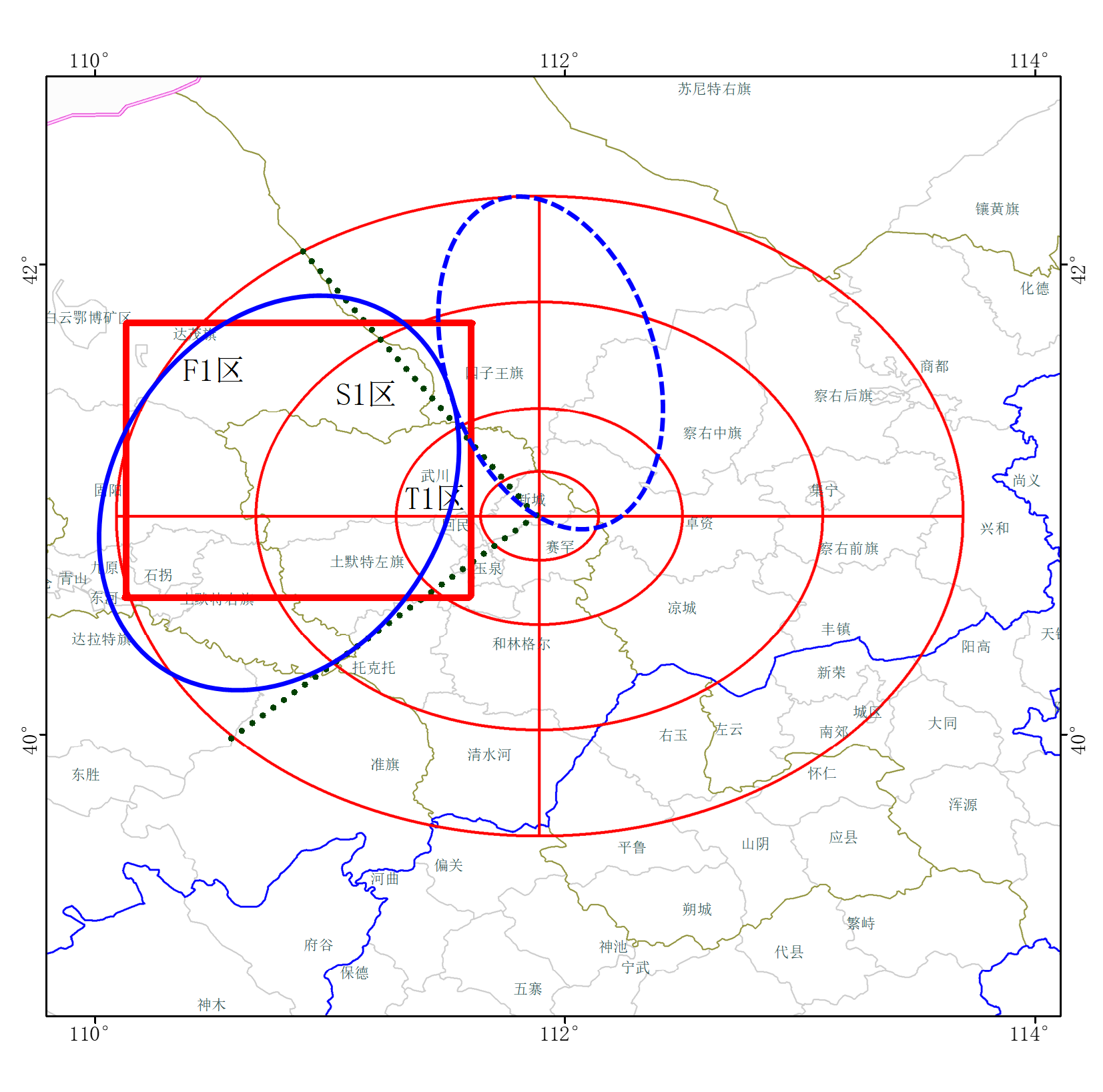
中文摘要: 为做好固定目标时段和区域的人工消减雨作业,利用云降水显式预报系统(CPEFS_v1.0)对云系性质和结构、移速移向及演变、降水机制等云条件进行预报。预报结果显示,2017年8月8日影响呼和浩特的云系性质为分散性对流云,具有冷暖混合云结构,云中上升气流强,对流单体水平尺度约为几十千米,生命史约为1.5~3 h,云顶高度约为10 km、云底高度约为3 km,0℃高度约为4.3 km;微观方面,冰相水凝物雪、霰含量高,暖区云水含量少,云中过冷水含量最大达0.7 g·kg-1,过冷水丰沛区域冰晶数浓度低,以冷云降水为主。初生在呼和浩特特定防护区西北方向的对流云团快速发展东移南压影响核心保障区,移速约为30~40 km·h-1。卫星、雷达等实况监测显示,8日的云系为分散性对流云,预报对流云的生成时间比实况偏晚1~2 h,移向与实况一致,移速偏慢10~20 km·h-1。在5 〖KG-*5〗400 m高度处(-8℃),机载云物理探测的液水含量最大为0.6 g·m-3,预报与实况接近。根据预报的云系条件制定作业预案指出,在核心保障区的偏西北方向30~50 km处进行重点布防,适宜在5.1~7.0 km高度处实施AgI过量催化,8日上午飞机在第一道防线的弱回波区开展探测作业,地面作业集中在第三道防线对流云初生阶段实施过量播撒,以达到消减雨作业的目标。根据预案,提前24 h在核心保障区偏西北方向的第三道防线增设了5个地面移动作业点,这些作业点8日及时实施了消减雨作业。总体看来,此次云条件预报正确、预案制定合理,及时为外场实施消减雨作业提供了支撑。
Abstract:In order to do well artificial rainfall mitigation on specific target period and area, cloud seeding condition such as cloud properties and structure, moving speed and direction, cloud evolution, precipitation mechanism and so on was forecast by using Cloud Precipitation Explicit Forecast System (CPEFS). The results showed that on 8 August 2017 in Hohhot there were scattering convective clouds, with cold warm mixed vertical structure and strong updrafts. Horizontal scale of single convective cloud was about tens of kilometers, and lifetime was about 1.5-3.0 hours. 〖JP2〗Cloud top (bottom) height of 10 (3) km, 〖JP〗and 0℃ layer height of 4.3 km. Cloud microphysics aspects were with high content of snow and graupel, low cloud water content in warm regions, maximum content of supercooled water of 0.7 g·kg-1, less ice crystals in areas with rich supercooled water, mainly with cold precipitation mechanism. Convective clouds first appeared in the northwest direction of the core zone in Hohhot, rapidly developing and moving eastward and southward gradually to the core zone at the speed about 30-40 km·h-1. Satellite and radar observations also showed there were convective clouds. The forecasted generation time of convective clouds was 1-2 hours later than observation, but moving direction was consistent with observation. Moving speed was 10-20 km·h-1 slower. The maximum liquid water content was 0.6 g·m-3 at the 5 〖KG-*5〗400 m height (-8℃) by airborne cloud physical detection. The forecasted cloud water content was consistent with detection. The seeding plan was made based on cloud condition forecast. The area 30-50 km northwest of the core zone was chosen as key defense zone. AgI over seeding would be suitable to be implemented in the 5.1-7.0 km height. In the morning of 8 August the aircraft would carry out detection in weak echo areas of the first defense line. Ground operations would focus on the implementation of over seeding in the initial stage of convective clouds in the third defense line to achieve the goal of rainfall mitigation. Based on the plan, additional five sets of ground mobile seeding equipment were added to reinforce the capability of rainfall mitigation ahead of 24 hours of target time. Rainfall mitigation was carried out with the 5 sets equipment. In summary, the cloud seeding condition forecast was proper, and the seeding plan was reasonable, which provided strong support for field rainfall mitigation action.
文章编号: 中图分类号:P481 文献标志码:
基金项目:国家重点研发计划(2018YFC1507900)和公益性行业(气象)科研专项(GYHY20120625)共同资助
| 作者 | 单位 |
| 史月琴 | 中国气象局云雾物理环境重点实验室,北京 100081 |
| 刘卫国 | 中国气象局云雾物理环境重点实验室,北京 100081 |
| 王飞 | 中国气象局云雾物理环境重点实验室,北京 100081 |
| 高扬 | 中国气象局云雾物理环境重点实验室,北京 100081 |
引用文本:
史月琴,刘卫国,王飞,高扬,2021.一次对流云人工消减雨作业云条件预报和作业预案合理性分析[J].气象,47(2):192-204.
SHI Yueqin,LIU Weiguo,WANG Fei,GAO Yang,2021.Forecast on Convective Cloud Condition and Analysis on Seeding Plan of an Artificial Rainfall Mitigation Case[J].Meteor Mon,47(2):192-204.
史月琴,刘卫国,王飞,高扬,2021.一次对流云人工消减雨作业云条件预报和作业预案合理性分析[J].气象,47(2):192-204.
SHI Yueqin,LIU Weiguo,WANG Fei,GAO Yang,2021.Forecast on Convective Cloud Condition and Analysis on Seeding Plan of an Artificial Rainfall Mitigation Case[J].Meteor Mon,47(2):192-204.