本文已被:浏览 1940次 下载 5064次
投稿时间:2017-09-24 修订日期:2018-05-22
投稿时间:2017-09-24 修订日期:2018-05-22
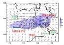
中文摘要: 2016年7月24日午后河北中东部至天津南部出现了一次短历时暴雨过程,暴雨中心位于天津南部,模式客观预报和预报员主观预报均存在偏差。利用常规地面高空观测资料、卫星云图、多普勒雷达探测资料和同化了雷达和地面加密资料的VDRAS资料等,对导致此次强降水过程形成原因进行分析,特别是对本次暴雨最为关键的问题——雷暴触发和传播机制进行了深入细致的分析,结果表明:(1)本次暴雨过程发生在副热带高压加强北上过程中,从传统流型识别的角度看不利于副热带高压西北侧的高空槽东移影响华北东南部,这是一次发生在副热带高压588 dagpm线控制下的暖区暴雨,是非典型流型下的短历时暴雨,预报难度大;(2)邢台探空较北京探空距离暴雨区更远,但对于副热带高压西北侧西南气流影响下的暖区暴雨,位于暴雨区西南的邢台探空更具参考价值,邢台站24日11时的订正探空显示:大气层结极不稳定、低层水汽异常充沛且湿层深厚,CAPE值达3874 J·kg-1,对流抑制仅为22 J·kg-1,8 g·kg-1比湿达600 hPa,地面露点出现接近30℃的极端高值;(3)850 hPa暖式切变线附近,两条地面辐合线合并和中尺度锋生是触发中尺度对流系统的重要因素,卫星云图上亦可见两条云带合并,其合并使得边界层辐合加强,因而积云在辐合区发展,暖切变线附近上午有小积云发展,随着辐合加强形成东西向排列中尺度对流系统;(4)雷暴触发后,其移动和传播是预报的难点,因其决定了对流降水持续时间,本例中受辐合线和风暴阵风出流共同作用,切变线西段有新的雷暴触发,加之切变线南侧南北向的云街与切变线相遇,使得雷暴在向西传播的同时向南发展,即传播方向为西偏南,在环境西南气流的作用下,对流单体向东偏北方向移动,即平流方向东偏北,平流与传播方向相反,因而形成“列车效应”,另外,南北向云街表明切变线南侧逆温层之下有偏南暖湿气流补充,加之对流风暴阵风的出流再次触发雷暴使得对流风暴持续。
中文关键词: 短时强降水, 辐合线, 暖区暴雨, 列车效应
Abstract:A short time torrential rain occurred in the afternoon of 24 July 2016, from the central and eas tern part of Hebei Province to southern Tianjin, which was the torrential rain center. For this torrential rain both the objective and forecasters subjective forecasts had biases. In this paper the causes of the precipitation are analyzed, especially the initiation and propagation mechanism of the torrential rain, which is the most critical problem, by using the conventional surface and upper air observation, satellite images, radar data and VDRAS data that assimilated the radar and AWS data. The results show that: (1) the torrential rain occurred as the subtropical high strengthened and extended northward. From the perspective of traditional identification, the circulation pattern didnt favor the northwest upper trough at the edge of subtro pical high moving eastward and influencing the southeast of North China. It was a warm sector torrential rain which occurred under the control of the 588 dagpm. It was a non typical circulation pattern short time severe rainfall, difficult to forecast. (2) Although the distance from Tianjin to Xingtai is farther than from Tianjin to Beijing, Xingtai Sounding Station located in the southwest of the torrential rain zone has more reference value under the influence of southwest airflow which is on the northwest side of subtropical high. At 11:00 BT, Xingtai sounding data showed that the atmosphere was extremely unstable and the low level water vapor was deep and unusually vigorous. The CAPE value was 3874 J·kg-1, CIN was 22 J·kg-1 and the height of 8 g·kg-1 specific humidity extended to 600 hPa. The surface dew point temperature was nearly 30℃. (3) Near the 850 hPa warm shear line, the two surface shear lines merged and mesoscale frontogenesis was the key factor of initiation. Two cloud bands were also visible on the satellite image, enhancing convergence. So cumulus clouds developed in the convergence zone, and small cumulus clouds developed in the morning near the warm shear line. As the convergence was strengthened, the mesoscale convective system was formed in the east west direction. (4) After thunderstorm is triggered, its movement and propagation are the difficulties of forecasting, because it determines the lasting time of convective precipitation. In this case, under the influence of the convergence line and the storm gusts, new thunderstorm initiation in the west part of the shear line, and the north south cloud street met the shear line on the south side of the shear line, causing the thunderstorm to spread westward and move southward. So the propagation direction was west by south. Under the influence of southwest airflow, the convective cells moved northeastward, namely, the advection direction was east, which was opposite to the direction of propagation. Thus, the “train effect” was formed. Cloud streets showed that there was a supplement of the south warm and humid air flow under the inversion layer in the south of the shear line. In addition, the convective storm gusts triggered new thunderstorms again, making convective storms sustained.
文章编号: 中图分类号: 文献标志码:
基金项目:国家自然科学基金项目(41475042、41575049和41475050)、公益性行业(气象)科研专项(GYHY201506006)、天津市自然科学基金(17JCYBJC23600)、天津市气象局气象预报预警创新团队和天津市气象局课题(201724ybxm14)共同资助
| 作者 | 单位 |
| 孙密娜 | 天津市气象台,天津 300074 |
| 王秀明 | 中国气象局气象干部培训学院,北京 100081 |
| 胡玲 | 天津市气象台,天津 300074 |
| 陈宏 | 天津市气象台,天津 300074 |
| 韩婷婷 | 天津市气象台,天津 300074 |
引用文本:
孙密娜,王秀明,胡玲,陈宏,韩婷婷,2018.华北一次暖区暴雨雷暴触发及传播机制研究[J].气象,44(10):1255-1266.
SUN Mina,WANG Xiuming,HU Ling,CHEN Hong,HAN Tingting,2018.Study on Initiation and Propagation Mechanism of a Warm-Sector Torrential Rain in North China[J].Meteor Mon,44(10):1255-1266.
孙密娜,王秀明,胡玲,陈宏,韩婷婷,2018.华北一次暖区暴雨雷暴触发及传播机制研究[J].气象,44(10):1255-1266.
SUN Mina,WANG Xiuming,HU Ling,CHEN Hong,HAN Tingting,2018.Study on Initiation and Propagation Mechanism of a Warm-Sector Torrential Rain in North China[J].Meteor Mon,44(10):1255-1266.