本文已被:浏览 1572次 下载 4889次
投稿时间:2017-01-19 修订日期:2018-01-12
投稿时间:2017-01-19 修订日期:2018-01-12
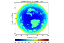
中文摘要: 采用60 m基线的双站可见光成像仪和扫描式红外成像仪构建地基双波段全天空测云系统,双站可见光成像仪根据双站测距原理准确地获取云底高,通过全方位立体扫描获取全天空可见光云图,扫描式红外成像仪基于大气辐射传输原理测量云底亮温,反演云底高度,通过全方位立体扫描获取全天空红外云图。结合双站可见光成像仪测得云底高,对大气温度垂直递减率进行实时订正,提高扫描式红外成像仪反演云底高精度,达到双波段云底高数据融合目的;基于小波变换多分辨率分析的图像融合技术,对全天空可见光和红外云图进行图像融合,提高能见度低、以及雾、霾等天气条件下云量计算准确度;最终实现昼夜云高、云量同时观测。
中文关键词: 双站成像,红外成像仪,小波变换,数据融合,双波段
Abstract:Using 60 m base-line binocular visible imager and scanning infrared imager, a dual-band whole sky cloud measurement and control system was built. According to the principle of binocular distance measurement, the binocular visible imager can accurately obtain the height of cloud base, and through comprehensive three-dimensional scanning the whole sky visible light cloud pictures were obtained. The scanning infrared imager can measure the temperature of cloud base and inverse the height of cloud base on the basis of the principle of atmospheric radiation transmission, and through comprehensive three-dimensional scanning, the whole sky infrared cloud pictures were obtained. Combined with the height of cloud base and the real-time correction of atmospheric temperature vertical decline rate, the binocular visible imager could measure the height of cloud base, improve the accuracy of inversion the height of cloud base of the scanning infrared imager, achieving the height of cloud base data fusion. Based on image fusion technology of wavelet multi-resolution analysis, the whole sky visible light and infrared cloud image are fused, improving cloud computing accuracy under the fog-haze conditions. Thus, cloud base height and cloud cover could be observed day and night.
文章编号: 中图分类号: 文献标志码:
基金项目:中国气象局关键技术集成与推广应用项目(CMAGJ2015M80)、国家自然科学基金项目(61531019)和江苏省气象局北极阁开放研究基金项目(BJG201602)共同资助
| 作者 | 单位 |
| 陶法 | 1 南京信息工程大学,南京 210044 2 中国气象局气象探测中心,北京 100081 |
| 胡树贞 | 中国气象局气象探测中心,北京 100081 |
| 张雪芬 | 中国气象局气象探测中心,北京 100081 |
引用文本:
陶法,胡树贞,张雪芬,2018.地基可见光/红外全天空成像仪数据融合[J].气象,44(4):518-525.
TAO Fa,HU Shuzhen,ZHANG Xuefen,2018.Data Fusion for Base Ground Visible/Infrared Whole Sky Imager[J].Meteor Mon,44(4):518-525.
陶法,胡树贞,张雪芬,2018.地基可见光/红外全天空成像仪数据融合[J].气象,44(4):518-525.
TAO Fa,HU Shuzhen,ZHANG Xuefen,2018.Data Fusion for Base Ground Visible/Infrared Whole Sky Imager[J].Meteor Mon,44(4):518-525.