本文已被:浏览 1164次 下载 2029次
投稿时间:2018-02-05 修订日期:2018-12-08
投稿时间:2018-02-05 修订日期:2018-12-08
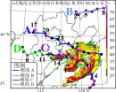
中文摘要: 综合利用多种观测资料和NCEP分析资料,分析了2016年6月30日发生在冷涡南部暖区的一次长生命史弓状飑线(以下简称飑线)的环境条件、触发、演变和维持机制以及预报难点。其发生环境条件为超过4000 J·kg-1以上的对流有效位能(CAPE)、中等强度0~6 km垂直风切变,是超级单体形成和维持的有利条件;湿球温度0℃高度3.6 km是有利大冰雹形成的融化层高度;整层相对干(对流层中层达28℃温度露点差)、大的垂直减温率和下沉对流有效位能(DCAPE)都是形成弓状回波和地面强风的有利条件。前期较大对流抑制能量(CIN)抑制了对流初生;随着地面温湿度增加CAPE显著增大、CIN减小,加之边界层辐合显著增强因而触发了对流。老的对流出流气流,环境低空西南气流增强为急流和上游的低空西北偏西气流增强了边界层辐合。飑线发展过程表现出以下特征:TBB演变表明飑线是由线状积云发展成为一个中尺度对流复合体,以正闪为主的闪电和地面大风主要分布于TBB低值处;可见光云图显示具有粗糙的纹理、显著的上冲云顶和旋转等特征;雷达反射率因子显示其由一个β中尺度线状对流系统发展成为一个α中尺度弓状飑线系统;成熟阶段具有显著的回波悬垂、有界弱回波区、中气旋、强中层后侧入流、后侧入流缺口、前侧入流缺口和中层径向速度辐合等特征,异常的垂直液态水含量值是产生大冰雹和雷暴大风的典型雷达回波特征;由于高层分流气流和其西侧不断有新生对流使其组织成非对称尖锥状。对流层中层大的温度露点差和强的后侧入流导致的强下沉辐散气流是形成弓状回波结构的主要原因。位于飑线前沿辐合区后侧的强前侧入流是飑线和弓状回波维持的主要原因。500 hPa风速初期偏弱后期增强、前期较大的CIN及后续迅速减小和抬升触发条件相对弱是该飑线的短期时效预报难点。
中文关键词: 弓状飑线,演变,触发,机理,冷涡
Abstract:Based on NCEP (National Centers of Environmental Prediction) analyses data and various observations from automatic weather stations, cloud-to-ground lightning positioning system, stationary meteo-rological satellites, and weather radars, this paper uses “ingredient-based method” to have comprehensively analyzed environmental conditions, evolution characteristics, trigger and development mechanisms, and forecasting difficulties of a long-lived arc-shaped squall line which swept the southeastern part of Hebei Province and most of Shandong Province on 30 June 2016. Convective available potential energy (CAPE) above 4000 J·kg-1 and 0-6 km vertical wind shear with moderate intensity were very favorable for the development of supercell storms, large hail, high winds and the maintenance of squall line. Level of the wet bulb temperature zero (WBZ) at 3.6 km altitude was in favor of large hail. Low relative humidity, dewpoint deficit of the middle troposphere up to 28℃, larger vertical temperature lapse rate and downdraft convective available potential energy (DCAPE) favored very much bow echoes and high winds. Convective inhibition energy (CIN) ≥200 J·kg-1 inhibited the earlier convection. The convection initiation of the squall line was triggered from a cumulus line under the impacts together with higher CAPE and less CIN made by increased surface temperature and humidity, significantly enhanced surface convergence line by the outflow of existing convective storms, enhanced convergence of boundary layer by the low-level southwesterly jet and the moving eastwards low-level northwesterly. Infrared temperature of black body (TBB) shows that the squall line developed from a linear cumulus line to a quasi-circular mesoscale convective complex, with mainly positive lightning and high winds in the low TBB area. Visible cloud images show that it had coarse texture, significant overshooting and rotation feature. Radar observations show that the squall line developed from a meso-β scale linear convective system to a meso-α-scale arc-shaped squall line with significant overhang echoes, bounded weak echo regions, mesocyclones, mesovortices, strong rear inflows, rear inflow notches, front inflow notches, mid-altitude radial convergences in mature stage, and extreme value of vertical integrated liquid, which are characteristics of storms producing large hail and high winds. And it was organized into an asymmetric carrot-like mode in the mature stage because of new convective storms initiated along the west side and the upper-level diffluent flows. Intense downdraft induced by high dewpoint deficit of the middle troposphere and strong rear inflow were the main cause for the formation of the bow echoes. The main causes of maintaining the squall line and bow echoes were the intense front inflow formed behind leading convergence line of the squall line. Weaker 500 hPa winds in the initial stage, larger CIN in the early morning, later CIN sharply decreasing, and weaker trigger condition were the difficulties of forecasting the squall line.
文章编号: 中图分类号: 文献标志码:
基金项目:国家重点研发计划(2018YFC1507504和2017YFC1502003)及国家自然科学基金项目(41375051)共同资助
| 作者 | 单位 |
| 公衍铎 | 中国气象科学研究院,北京 100081, 国家气象中心,北京 100081, 黑龙江省气象台,哈尔滨 150001 |
| 郑永光 | 中国气象科学研究院,北京 100081, 国家气象中心,北京 100081 |
| 罗琪 | 中国气象科学研究院,北京 100081, 国家气象中心,北京 100081 |
引用文本:
公衍铎,郑永光,罗琪,2019.冷涡底部一次弓状强飑线的演变和机理[J].气象,45(4):483-495.
GONG Yanduo,ZHENG Yongguang,LUO Qi,2019.Evolution and Development Mechanisms of an Arc-Shaped Strong Squall Line Occurring Along the South Side of a Cold Vortex[J].Meteor Mon,45(4):483-495.
公衍铎,郑永光,罗琪,2019.冷涡底部一次弓状强飑线的演变和机理[J].气象,45(4):483-495.
GONG Yanduo,ZHENG Yongguang,LUO Qi,2019.Evolution and Development Mechanisms of an Arc-Shaped Strong Squall Line Occurring Along the South Side of a Cold Vortex[J].Meteor Mon,45(4):483-495.