本文已被:浏览 0次 下载 0次
投稿时间:2024-12-12 修订日期:2025-07-04
投稿时间:2024-12-12 修订日期:2025-07-04
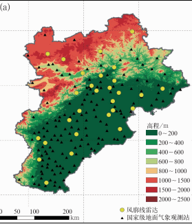
中文摘要: 利用京津冀地区2023—2024年4—9月风廓线雷达资料,借助三角形中尺度组网反演了4 km以下关键动力参数廓线,分析了对流触发前动力场的演变特征。结果表明:对流触发前,动力场表现为低层辐合、高层辐散的垂直上升运动特征。区域平均降水量与对流层中低层辐合和上升运动整体上存在正滞后相关性。降水前30 min内,水平散度小于-5×10⁻⁵ s-1,1 km以下的辐合厚度加深,增强的正涡度和持续加强的辐合上升运动有利于对流发生。可将30 min内水平辐合强度持续大于50×10-5 s-1作为对流触发信号判别指标。在统计的763次降水事件中,对流触发信号判别指标的有效识别降水事件准确率为72.3%,为定量分析京津冀地区对流早期预警提供重要参考。
中文关键词: 风廓线雷达,对流触发,辐合上升,京津冀地区
Abstract:In this study, we analyze the evolution of the dynamical field before the occurrence of convection by using the dynamical parameter profiles below 4 km inverted from the wind profile radar mesoscale network from April to September during 2023-2024. The results show that before the convection triggering, the dynamical field is characterized by a vertical upward motion configuration with low-level convergence and high-level divergence. There exists the presence of positive time-lag correlations between area averaged rainfall and convergence in the lower to mid-troposphere. During the 30 min before precipitation, horizontal divergence is less than -5×10⁻⁵ s-1, with the convergence thickness below 1 km deepening, which means that the continuously enhanced convergence and upward motion favors the occurrence of convection. The horizontal convergence intensity sustained to be greater than 50×10-5 s-1 in the 30 min prior to precipitation is used as an indicator for the early signal of convection triggering. Among 763 precipitation events, the accuracy rate of effective identification of precipitation events is 72.3%. These findings can provide an important reference for quantitatively analyzing the early warning of severe convection in Beijing-Tianjin-Hebei Region.
文章编号: 中图分类号: 文献标志码:
基金项目:中国气象局大气探测重点开放实验室课题(2023KLAS02M)、中国气象局“揭榜挂帅”科技项目(CMAJBGS202307)和中国气象局雄安大气边界层重点开放实验室开放课题(2023LABL-B06)共同资助
引用文本:
杨荣芳,郭建平,孔凡超,孟德利,张震,郭晓冉,单昱峰,邓剑波,2025.京津冀地区风廓线雷达组网的对流触发信号判别[J].气象,51(10):1249-1260.
YANG Rongfang,GUO Jianping,KONG Fanchao,MENG Deli,ZHANG Zhen,GUO Xiaoran,SHAN Yufeng,DENG Jianbo,2025.Discrimination of Convection Triggering Dignals from the Wind Profiler Radar Mesoscale Network in Beijing-Tianjin-Hebei Region[J].Meteor Mon,51(10):1249-1260.