本文已被:浏览 504次 下载 3154次
投稿时间:2021-02-18 修订日期:2021-06-10
投稿时间:2021-02-18 修订日期:2021-06-10
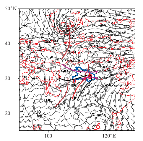
中文摘要: 利用自动气象站逐小时和逐5 min观测资料、长江中游雷达组合反射率因子SWAN拼图产品及NCEP FNL再分析资料,对武汉地区4次低质心类短时强降水对流风暴特征进行分析。结果表明:不同的天气背景诱发的对流系统特征不同,低层暖强迫造成的斜压不稳定背景下,环境条件高能高湿,雷暴冷池的积累有利于稳定性降水前沿触发线状强对流;斜压锋生天气背景下,冷暖剧烈交汇使得大气斜压性显著增强,地面多有中尺度气旋波发展,锋区冷区稳定性降水中多伴随短时强降水,而暖区能量、湿度条件更好,易诱发短时强降水等分散性强对流;准正压天气背景下,大气斜压性弱,环境高能高湿,多由近地面层流场强迫和局地热力差异触发剧烈的热对流活动。从对流风暴雷达回波特征和降水特征来看,TS类线状中尺度对流系统(MCS)移速较快,短时强降水范围小;准静止类表现为带状走向的大范围层状云回波稳定维持,中间伴有多个积云对流生消迭代,每一阶段降水增强都与新生对流单体途经武汉站点相对应;组织合并类在回波合并时,意味着短时强降水的发展增强,合并后的回波形态和走向影响着降水的强度和持续时间。在不同的环境背景、触发诱因和组织形态下,短时强降水发生前后地面气象要素表现出不同的变化特征,锋面特征和对流触发位置的不同导致温度变化特征差异。地面中尺度系统对于MCS的触发、组织发展有重要作用,其生消演变相对于MCS在时间上通常具有一定的提前量,关注地面辐合线、温度锋区等地面中尺度系统,对于预判MCS的触发、组织形态的演变等具有很好的指示意义。
Abstract:Based on hourly and 5 min observation data of automatic weather station, SWAN mosaic product of radar composite reflectivity in the middle reaches of the Yangtze River and NCEP FNL reanalysis data, the characteristics of four convective storms with low-echo-centroid of short-term heavy precipitation in Wuhan are analyzed. The results show that the characteristics of convective system induced by different weather backgrounds are different. Under the background of baroclinic instability caused by low-level warm forcing, the environmental conditions are high energy and high humidity, and the accumulation of thunderstorm cold pool is conductive to triggering linear severe convection in the stable precipitation front. Under the baroclinic frontogenesis background, the convergence of cold and warm air is intense, strengthening the baroclinicity; there are more mesoscale cyclonic waves on the ground, and the stable precipitation in the front area is often accompanied by a short-time heavy rainfall. Under the quasi barotropic background, the baroclinic atmosphere is weak, but the high-energy and high-humidity environment as well as the near-surface flow field forcing and local thermal difference are easy to trigger severe thermal convection activities. In addition, according to the radar echo characteristics and precipitation characteristics of convective storms, the TS (trailing stratiform cloud) type moves faster, resulting in a small range of short-time heavy rainfall. Quasi-stationary type shows that the echoes of large-scale stratiform cloud with zonal trend are stable, and there are multiple cumulus convective echoes in the middle. The precipitation enhancement in each stage corresponds to the new convective cell passing through Wuhan Station. The consolidation type is in the circulation when the waves merge, often accompanied by the occurrence of heavy rainfall, and the echo shape and direction after merging affect the intensity and duration of precipitation. Actually, under different environmental backgrounds, triggering inducement and organizational form, the surface meteorological elements before and after the occurrence of short-time heavy rainfall show different change characteristics. The different fronts and convection triggering positions lead to different changes in temperature. Ground mesoscale system plays an important role in triggering and organizing the development of mesoscale convective system (MCS). Its generation, elimination and transformation usually have a certain advance in time for MCS. So, paying attention to the development and evolution of ground mesoscale systems such as ground convergence line and temperature front area is of great significance for predicting the triggering and organizational evolution of MCS.
文章编号: 中图分类号: 文献标志码:
基金项目:国家重点研发计划(2018YFE0196000)资助
引用文本:
王孝慈,李双君,孟英杰,2022.武汉地区4次低质心类短时强降水对流风暴特征分析[J].气象,48(5):633-646.
WANG Xiaoci,LI Shuangjun,MENG Yingjie,2022.Characteristics of Four Low-Echo-Centroid Convective Storms of Short-Time Heavy Rainfall in Wuhan[J].Meteor Mon,48(5):633-646.
王孝慈,李双君,孟英杰,2022.武汉地区4次低质心类短时强降水对流风暴特征分析[J].气象,48(5):633-646.
WANG Xiaoci,LI Shuangjun,MENG Yingjie,2022.Characteristics of Four Low-Echo-Centroid Convective Storms of Short-Time Heavy Rainfall in Wuhan[J].Meteor Mon,48(5):633-646.