本文已被:浏览 2003次 下载 4775次
投稿时间:2018-10-24 修订日期:2019-12-27
投稿时间:2018-10-24 修订日期:2019-12-27
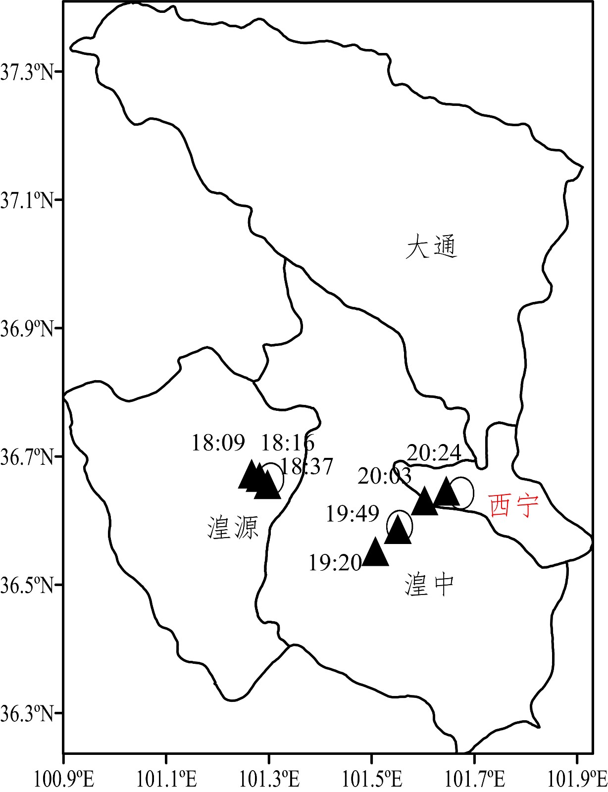
中文摘要: 分析2010—2016年西宁强降水多普勒天气雷达径向速度图特征及预警指标,结果表明:西宁强降水的径向速度图上往往会出现逆风区,且直接受影响的混合性强降水Ⅰ类逆风区略多,对流性强降水多为Ⅱ类,总体上逆风区以东北向移动为最多。逆风区较强降水出现时间有一定的提前量,且强降水落区在逆风区及其移动路径附近,逆风区既是强降水预警的时效性判据,也是识别强降水落区及路径的有用判据。逆风区切变流场的辐合(散),将增强(减弱)强降水的发展,且辐合(散)的出现提前于强降水的开始(结束)时间。强降水前1 h的垂直风切变特征为混合性强降水低层最大、中层最小,对流性强降水各层则均明显大;低—中—高层冷、暖平流配置的混合性强降水主要表现为深厚暖平流,对流性强降水则平流不明显或低、中层有暖平流。对流性强降水最大回波高度和零速度层均较混合性强降水高,但其总体差别较小。综合应用径向速度得到的强降水临近预警指标,其准确率达到78.6%。
中文关键词: 多普勒雷达径向速度,垂直风场,强降水,预警
Abstract:The characteristics of heavy rainfall events on the Doppler weather radar velocity images and their early warning indicators in Xining from 2010 to 2016 are analyzed. The results show that the adverse wind region (AWR) on radial velocity images often occurs in the case of heavy rainfall events in Xining. Type Ⅰ AWR is slightly more for the mixed heavy rainfall and type Ⅱ AWR is mostly for the convective heavy rainfall during the directly affected heavy rainfall events. The AWR moves mostly northeastward in general. The occurring times of the AWR have certain lead times before the beginning of heavy rainfall events, and heavy rainfall falls near the AWR and its moving path, that is, the AWR is not only a time based criterion for issuing early warnings of heavy precipitation but also a useful criterion for identifying falling areas of heavy rainfall. When the shear flow field in the AWR is convergent (divergent), it will enhance (weaken) the development of heavy rainfall, and the time of the convergence (divergence) is ahead of schedule the beginning (end) of heavy rainfall. At the time 1 h before the beginning of heavy rainfall, the vertical wind shear is the largest in low level and the smallest in middle level of the mixed heavy rainfall. However, it is obviously large in all the levels during convective heavy rainfall. The changes in wind direction mainly show deep and warm advection for the mixed heavy rainfall, while they are not obvious or there is warm advection in the low and middle levels for the convective heavy rainfall. The maximum echo heights and zero speed layers are higher for the convective heavy rainfall than for the mixed heavy rainfall, but there are smaller differences on the whole for the convective heavy rainfall. The indicators for early warning of heavy rainfall by comprehensive application of the radial velocity are obtained, and the accuracy rate reaches 78.6%.
文章编号: 中图分类号:P412 文献标志码:
基金项目:青海省西宁市气象局重点项目(201611)和青海省西宁市气象局强降水预报方法研究创新团队共同资助
引用文本:
谢启玉,魏国财,张令振,赵娟,2020.西宁强降水的多普勒雷达径向速度图特征研究[J].气象,46(2):269-277.
XIE Qiyu,WEI Guocai,ZHANG Lingzhen,ZHAO Juan,2020.Characteristics of Doppler Radar Radial Velocity Images for Heavy Rainfall Events in Xining[J].Meteor Mon,46(2):269-277.
谢启玉,魏国财,张令振,赵娟,2020.西宁强降水的多普勒雷达径向速度图特征研究[J].气象,46(2):269-277.
XIE Qiyu,WEI Guocai,ZHANG Lingzhen,ZHAO Juan,2020.Characteristics of Doppler Radar Radial Velocity Images for Heavy Rainfall Events in Xining[J].Meteor Mon,46(2):269-277.