本文已被:浏览 1277次 下载 4534次
投稿时间:2019-10-08 修订日期:2019-10-18
投稿时间:2019-10-08 修订日期:2019-10-18
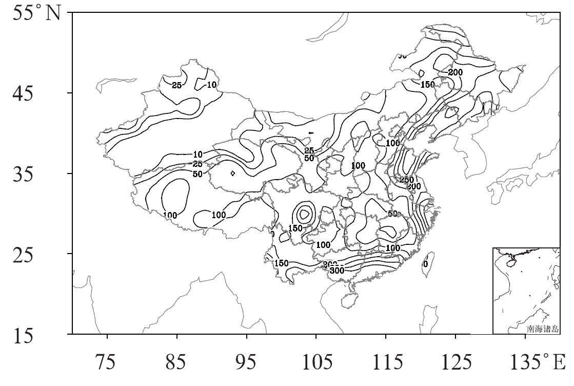
中文摘要: 2019年8月,北半球极涡呈单极型分布,强度偏强;亚洲大陆中高纬为两槽一脊型;西北太平洋副热带高压明显偏北,大陆高压偏强。8月全国平均降水量为110.5 mm,较常年同期(105.3 mm)偏多5.0%;全国平均气温为21.6℃,较常年同期(20.8℃)偏高0.8℃。月内共出现了5次主要的区域性强降水过程,其中3次降水活动与台风有关。8月共有6个热带气旋(风力8级以上)在西北太平洋和南海海域活动,其中“韦帕”、“利奇马”、“白鹿”共3个台风登陆我国。月内,东北及四川等地遭受暴雨洪涝灾害;长江中下游气象干旱发展;南方出现大范围持续高温天气; 多省(区、市)遭受风雹袭击,部分地区受灾较重。
中文关键词: 大气环流,副热带高压,台风,高温
Abstract:The main characteristics of the general atmospheric circulation in August 2019 are as follows. The polar vortex of Northern Hemisphere presented a single pattern. In the mid-high latitudes of Asia, the circulation presented a two-trough and one-ridge pattern. The Northwest Pacific subtropical high lay northward, and the subtropical high on land was stronger than the average. Meanwhile, the monthly mean precipitation amount was 110.5 mm, which is more than its normal value (105.3 mm) with 5.0% increase. The monthly mean temperature was 21.6℃, 0.8℃ higher than its climatological mean (20.8℃). Five regional torrential rainfall events happened in August, and three of them were caused by tropical cyclone. In August, six tropical cyclones were active over the Northwest Pacific and the South China Sea, and Typhoon Wipha (1907) and Lekima (1909) and Bailu (1911) made landfall over China. Northeast China and Sichuan suffered from heavy rains and floods. Drought appeared over middle and lower reaches of the Yangtze River. Persistent high-temperature occurred in the south of China. Many provinces suffered from hail attacks, and some areas had serious disasters.
文章编号: 中图分类号: 文献标志码:
基金项目:
| Author Name | Affiliation |
| ZHOU Guanbo | National Meteorological Centre, Beijing 100081 |
| GAO Shuanzhu | National Meteorological Centre, Beijing 100081 |
引用文本:
周冠博,高拴柱,2019.2019年8月大气环流和天气分析[J].气象,45(11):1621-1628.
ZHOU Guanbo,GAO Shuanzhu,2019.Analysis of the August 2019 Atmospheric Circulation and Weather[J].Meteor Mon,45(11):1621-1628.
周冠博,高拴柱,2019.2019年8月大气环流和天气分析[J].气象,45(11):1621-1628.
ZHOU Guanbo,GAO Shuanzhu,2019.Analysis of the August 2019 Atmospheric Circulation and Weather[J].Meteor Mon,45(11):1621-1628.