本文已被:浏览 1502次 下载 5108次
投稿时间:2018-01-24 修订日期:2019-03-29
投稿时间:2018-01-24 修订日期:2019-03-29
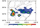
中文摘要: 使用Lu(2017)改进的温带气旋识别和追踪方法得出的江淮气旋资料,统计分析了近40年夏季江苏引发暴雨的江淮气旋概况、路径、形势特征和对应暴雨的主要落区。结果表明,夏季江淮气旋造成江苏暴雨的频次空间上在江淮之间最多,并向北和向南依次递减;时间上在6月最多,约占该月暴雨总次数的1/3。致暴江淮气旋暴雨落区与江淮气旋的路径有一定的对应关系,在淮北和江淮地区,暴雨在致暴江淮气旋过境地区均匀分布,但在苏南地区,暴雨主要集中在苏南的中西部。致暴江淮气旋天气形势可分为偏西气流型和低槽型两类,其中低槽型出现的次数约为偏西气流型的2倍。偏西气流型暴雨区位于500 hPa南侧暖湿的西南气流与北侧西北气流的过渡带中,低槽型暴雨区位于槽前西南气流中。850 hPa两种类型基本相似,都为闭合的低涡,且低涡位置相比于700 hPa明显南移。江淮和苏南地区的暴雨落区大都位于700 和850 hPa低涡中心的南侧、700 hPa急流的北部和850 hPa急流的北侧。偏西气流型和低槽型造成的暴雨范围基本相当,但低槽型产生的暴雨量要大于偏西气流型。
中文关键词: 江淮气旋,夏季,暴雨,路径,西南急流
Abstract:Using Jianghuai cyclone data obtained from Lu (2017) improved method of identifying and tracking of extratropical cyclone, this paper statistically analyzed the overview, path, circulation characteristics and corresponding rainstorm distribution of Jianghuai cyclone which brought the regional heavy rain of Jiangsu in summer in recent 40 years. The results show that most heavy rains in Jiangsu Province located between Yangtze River and Huaihe River are caused by Jianghuai cyclone in summer. The heavy rain caused by the summer Jianghuai cyclone is the most in June, accounting for about 1/3 of total number of heavy rains in this month. The rainstorm areas caused by Jianghuai cyclone are related to the path of cyclone, especially in the areas of north of Yangtze River where the heavy rains are evenly distributed on both sides of the cyclone path. However, heavy rain is mainly concentrated in the western and central sections of the cyclone path in south of Yangtze River. The circulation conditions causing heavy rain by Jianghuai cyclone can be divided into two types, which are the westward flow and the low trough patterns. The number of low trough pattern appears to be about twice of westward flow pattern. The heavy rain area is located in the transitional zone between warm and humid southwest airflow and northwest airflow at 500 hPa in the westward flow pattern and the heavy rain area of low trough pattern is located in southwest flow ahead of the trough. The two types of 850 hPa circulation conditions are similar basically, both of which are closed vortices, and the vortex position is obviously southward compared with 700 hPa. Most of heavy rain areas are located in the south side of 700 hPa and 850 hPa vortex centers and the north of 700 hPa and 850 hPa jet in south of Huaihe River. The areas of heavy rain caused by westward flow and low trough pattern are same, but the rain caused by low trough pattern is heavier than that of westward flow pattern.
文章编号: 中图分类号: 文献标志码:
基金项目:江苏省自然科学基金项目(BK20161603)、国家自然科学基金项目(41575081)、中国气象局预报员专项(CMAYBY2019-043)和江苏省气象局预报员专项(JSYBY201809)共同资助
| 作者 | 单位 |
| 黄文彦 | 江苏省常州市气象局,常州 213022 |
| 孙燕 | 江苏省气象科学研究所,南京 210009 |
| 卢楚翰 | 南京信息工程大学气象灾害教育部重点实验室/气候与环境变化国际合作联合实验室/气象灾害预报预警与评估协同创新中心,南京 210044 |
| 姚丽娜 | 江苏省常州市气象局,常州 213022 |
| 董芹 | 江苏省常州市气象局,常州 213022 |
引用文本:
黄文彦,孙燕,卢楚翰,姚丽娜,董芹,2019.近40年夏季江苏引发暴雨的江淮气旋统计分析[J].气象,45(6):843-853.
HUANG Wenyan,SUN Yan,LU Chuhan,YAO Lina,DONG Qin,2019.Statistical Analysis of Jianghuai Cyclone Causing Jiangsu Regional Heavy Rain in Summer Nearly 40 Years[J].Meteor Mon,45(6):843-853.
黄文彦,孙燕,卢楚翰,姚丽娜,董芹,2019.近40年夏季江苏引发暴雨的江淮气旋统计分析[J].气象,45(6):843-853.
HUANG Wenyan,SUN Yan,LU Chuhan,YAO Lina,DONG Qin,2019.Statistical Analysis of Jianghuai Cyclone Causing Jiangsu Regional Heavy Rain in Summer Nearly 40 Years[J].Meteor Mon,45(6):843-853.