本文已被:浏览 1176次 下载 4661次
投稿时间:2017-12-27 修订日期:2018-05-24
投稿时间:2017-12-27 修订日期:2018-05-24
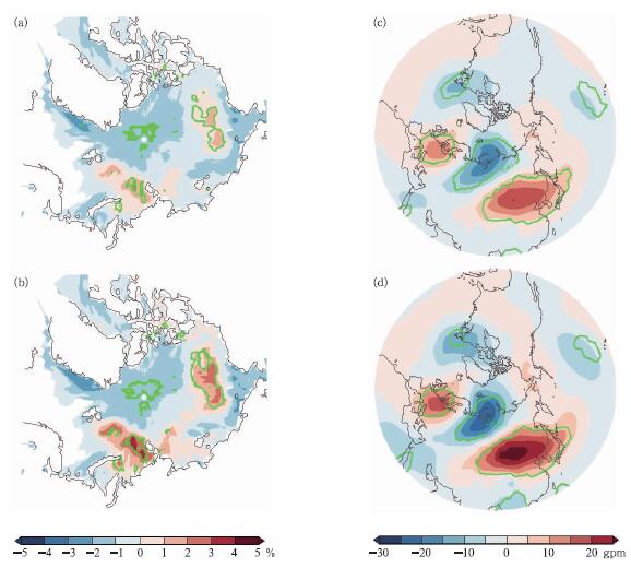
中文摘要: 利用ERA interim的再分析资料和英国大气数据中心的海冰密集度资料,通过复矢量经验正交分析方法(CVEOF),本文研究了自1979—2016年37个冬季(12月1日至次年2月28日)共3330 d对流层中层500 hPa欧亚盛行天气型主要时空变化特征及其与近年来北极对流层中、低层增暖异常和北极海冰减少的可能联系。结果表明,CVEOF1解释了总异常动能的15.82%,其两个子模态空间型分别表现为三极子型(0°和180°位相)和偶极子型(90°和270°位相)。其中,180°和270°位相的天气型发生时,冬季北极对流层中、低层偏暖,盛行暖北极 冷欧亚的大气环流形势。前期秋季从巴伦支海海域以东到波弗特海海域的海冰密集度(SIC)异常偏少可能是其影响因素之一。近年来这两个位相(180°和270°位相)的发生频次逐渐增多,与冬季频发的极端低温事件有紧密联系。在2005/2006年和2011/2012年冬季的冷事件中,180°和270°位相的发生频次明显偏多。因此,秋季从巴伦支海海域以东到波弗特海海域的SIC偏少,冬季北极对流层中、低层异常偏暖,有利于180°和270°位相天气型盛行,可能是导致冬季极端天气事件频发的主要原因之一。
中文关键词: 北极增暖,海冰减少,冬季盛行天气型
Abstract:Based on the reanalysis data of ERA interim and sea ice concentration data of the British Atmospheric Data Centre (BADC), the main spatio temporal variation characteristics of the prevailing Eurasian weather pattern at 500 hPa in the middle troposphere over 3330 days during 1979-2016 and its possible relationship with the anomalies in the mid lower troposphere over the Arctic and the decrease of Arctic sea ice in the recent years are analyzed by using the complex vector empirical orthogonal function (CVEOF). The results show that CVEOF1 accounts for 15.82% of the total anomalous kinetic energy and its two sub patterns are represented by tripole patterns (0° phase and 180° phase) and dipolar patterns (90° phase and 270° phase). The weather patterns of 180° phase and 270° phase were observed in winter when the mid low troposphere over Actic in winter was warmer than normal and the warm Arctic cold Eurasian atmosphere circulation prevailed in the Northern Hemisphere. In addition, sea ice concentration of the Barents Sea east to the Beaufort Sea was less than normal in autumn, which might be one of the impact factors. Furthermore, the prevailing weather patterns (180° phase and 270° phase) have been increasing in the recent years, and are also closely linked to the extreme weather events in winter. Take the winter of 2005/2006 and the winter of 2011/2012 examples. During the cold events of the two years, the frequency of 180° phase and 270° phase was obviously more than normal, accounting for the majority days of winter. Therefore, sea ice of the Barents Sea east to the Beaufort Sea less than normal in autumn, Arctic middle and lower troposphere in winter warmer than normal, 180° phase and 270° phase weather patterns prevailing in winter might be the impact factors for frequent winter extreme weather events.
文章编号: 中图分类号: 文献标志码:
基金项目:国家自然科学基金项目(41790472,41475080,41730959)和国家重点基础研究发展计划(973计划)(015CB453200)共同资助
引用文本:
李思,武炳义,2019.冬季欧亚大陆盛行天气型与北极增暖异常的可能联系[J].气象,45(3):345-361.
LI Si,WU Bingyi,2019.Possible Connection Between Arctic Warming and Eurasia Winter Prevailing Weather Patterns[J].Meteor Mon,45(3):345-361.
李思,武炳义,2019.冬季欧亚大陆盛行天气型与北极增暖异常的可能联系[J].气象,45(3):345-361.
LI Si,WU Bingyi,2019.Possible Connection Between Arctic Warming and Eurasia Winter Prevailing Weather Patterns[J].Meteor Mon,45(3):345-361.