本文已被:浏览 1133次 下载 2531次
投稿时间:2018-10-10 修订日期:2018-10-28
投稿时间:2018-10-10 修订日期:2018-10-28
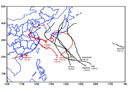
中文摘要: 2018年8月大气环流的主要特征是极涡呈单极型分布且强度偏强,亚欧洲大陆中高纬为多波型,西北太平洋副热带高压西脊点偏西,强度接近常年略偏强。8月全国平均气温21.9℃,较常年同期偏高1.1℃,为1961年以来历史同期第四高;全国平均降水量127.7 mm,比常年同期(105.3 mm)偏多21.3%,与历史同期相比呈现中部偏少的分布特征。月内我国有11次区域性暴雨天气过程,多站出现极端日降水量。8月共有10个热带气旋在西北太平洋和南海活动,其中1812号台风云雀、1814号台风摩羯、1816号台风贝碧嘉、1818号台风温比亚登陆,生成和登陆个数较常年偏多。我国中东部出现持续性高温天气,同时强对流天气频发,影响范围较广。
中文关键词: 暴雨,高温,热带气旋,变性过程,台风温比亚
Abstract:The main characteristics of the general atmospheric circulation in August 2018 were as follows. There was one polar vortex center in the Northern Hemisphere and stronger than usual. The circulation in Eurasian middle high latitudes showed a multi wave pattern. The strength of western North Pacific subtropical high was much stronger and the location was west compared to normal years. The monthly mean temperature was 21.9℃, 1.1℃ higher than normal, which ranks the fourth highest since 1961. The monthly mean precipitation amount was 127.7 mm, which was more than normal (105.3 mm) by 21.3%, and the precipitation in central China was less than usual. Eleven rainfall processes with some extreme records occurred in China this month. Ten tropical cyclones were active over the western North Pacific and the South China Sea. Among them, Typhoons Jongdari (1812), Yagi (1814), Bebinca (1816) and Rumbia (1812) made landfall in China. The total and landing numbers of tropical cyclones were more than usual. Long lasting high temperature events happened in central and eastern China. Meanwhile, convection events occurred frequently with a wide range of influencing areas.
keywords: torrential rain, high temperature, tropical cyclone, extra tropical transition, Typhoon Rumbia
文章编号: 中图分类号: 文献标志码:
基金项目:
| Author Name | Affiliation |
| WANG Qian | National Meteorological Centre, Beijing 100081 |
| ZHANG Ling | National Meteorological Centre, Beijing 100081 |
引用文本:
王皘,张玲,2018.2018年8月大气环流和天气分析[J].气象,44(11):1501-1508.
WANG Qian,ZHANG Ling,2018.Analysis of the August 2018 Atmosphere Circulation and Weather[J].Meteor Mon,44(11):1501-1508.
王皘,张玲,2018.2018年8月大气环流和天气分析[J].气象,44(11):1501-1508.
WANG Qian,ZHANG Ling,2018.Analysis of the August 2018 Atmosphere Circulation and Weather[J].Meteor Mon,44(11):1501-1508.